Drone Surveying And Mapping Services
Request Service
Hero Request Form
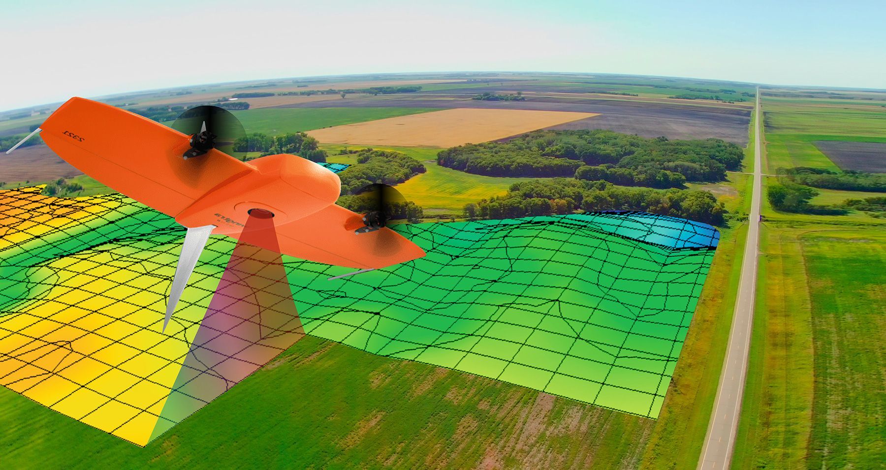
Skilled Drone Surveying and Mapping
Airgronomy delivers advanced surveying and mapping solutions tailored for the agricultural sector across the Continental U.S. Our services encompass:
- Topographical surveys
- Accurate terrain modeling
- Large-area mapping
- Remote location visualization
- Specialized site assessment
With Airgronomy's cutting-edge technology, you can gain invaluable insights into your farmland, even in hard-to-reach areas. Ready to elevate your agricultural planning? Get in touch with our team today.
Importance of Surveying and Mapping
Modern agriculture demands precision, and that's where Airgronomy's surveying and mapping services shine. Our state-of-the-art aerial technology provides:
- Comprehensive topographical data
- High-resolution 3D modeling
- Extensive coverage of large agricultural areas
- Access to remote or restricted locations
- Detailed terrain analysis
The Airgronomy Advantage
When you choose Airgronomy for your surveying and mapping needs, you're partnering with industry leaders. Our advantages include:
- Forward-thinking approach to agriculture
- Cutting-edge surveying equipment
- Licensed and insured drone pilots
- Next-business day free estimates
- Attractive customer referral discounts
Contact Us
Don't let outdated or incomplete land information hold your farm back. Airgronomy's surveying and mapping services provide the accurate, comprehensive data you need to make smart decisions. Our team is ready to help you unlock your land's full potential. Request a service from Airgronomy today, and take the first step towards more efficient, productive farming.
Share On: